Céad míle fáilte go Tourmakeady
Hill Walking in Tourmakeady:
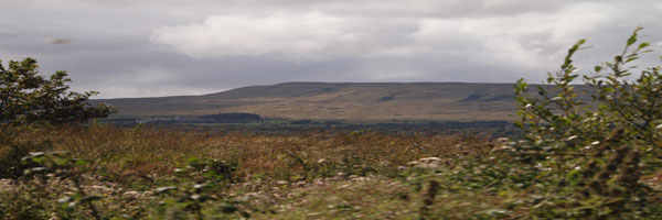
Tourmakeady is situated at the base of the Partry Mountains and along the western shore of Lough Mask. The scenery is outstanding and it is the perfect for an evening stroll, or for the more energetic hillwalker. The local tourism group organised the mapping of some walks in the area from Finney to Tourmakeady. The maps are drawn up by Joe McDermott.. Walking in the hills inevitably means walking over bog or peat. Bog is the Gaelic word meaning soft and every hill walker knows exactly what this means.
(There are copies of the maps on the following pages but original copies may be obtained from the local Tourism Office. While every care has been taken in compiling these maps, Tourmakeady Tourism Group, it's servants or agents, are not liable for any loss, injury damage or inconvenience sustained or caused as a result of using these guides.)
Walk Number 8- The Lough Nafooey Walk:
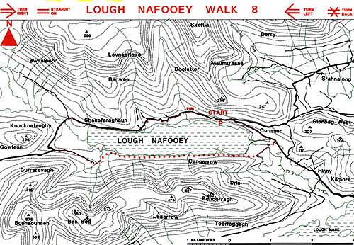
This is a pleasant walk, at all times the walker can view the entire walk as it encircles the lake. From the car park proceed east along the road toward Finny and sharp right down the bog road to the Finny River Cross by the bridge and follow track to a sharp turn, then by footpath to the ruined farmhouse. It is a matter of choice thereafter whether to follow the lake shore or maintain some height. A barely discernible track follows the lake for a few kilometres before totally disappearing. Care should be taken when crossing the stream by the cluster of farm buildings at the west end of the lake. After this the route is straightforward returning by road to the car park.